I thought it might be informative to write a short history to help understand the significance of this place to history, as we are getting support for the 186 Mile Project from folks that are far enough away to not have much experience of this treasure of a National Park.
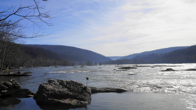
The Potomac River was first discovered by Europeans in 1571 by a Spanish Admiral named Pedro Menendez. Admiral Menendez was also the Governor of Spanish Florida. He journeyed upriver from the Chesapeake Bay and went as far as Occoquan Creek, about twenty-five miles downriver from the future site of Washington DC. Captain John Smith, of Jamestown fame, is the first Englishman to ascend up the Potomac in 1608. In 1632 King Charles the First of England granted Cecelius Calvert, First Lord Baltimore, a charter for the Province of Maryland. Later Calverts became Proprietors of the Colony of Maryland and Avalon (Avalon was a short lived venture to place a colony in New Brunswick, Canada).
Settlement ensued much to the detriment of the Native Americans who figured out a long time before the Europeans got there that it was a great place to live. By the middle of the 18th century the two most powerful countries of the time, England and France, were locked in a war for the future soul of North America. This was the French and Indian War, 1756 to 1763. Sir Winston Churchill, the great British leader and historian stated that this was the first truly world war as by the end it had spread to Europe, South America, the oceans and seas all around the world, and every major world power was involved. In Europe it is known as the Seven Years War.
In North America, two major goals of both the English and the French forces was to control water routes both to the north, from New England into Canada to the west, the Ohio River, which is the main concern of our story. If you could control access to the Ohio River you could control both the routes up into central Canada as well as the routes down river, mostly the Mississippi drainage all the way into the Gulf of Mexico. By gaining this control the land in between the English Colonies and the Mississippi River would belong to the side that won the war. Through harsh learning process, the English finally won the war opening up the opportunity for colonial expansion into the rich farmlands of the Ohio Valley. Many folks have the erroneous idea that in colonial times everyone rode around on horses and wagon trains hauled goods and produce, the reality was that the eastern part of North America was old growth forest. There were no roads and there was very little grass or grains for horses to eat, so everybody walked, or more importantly, used the natural highways of the rivers and streams. Boats and canoes were the most practical way to get around.
A young Virginian, you might have heard of, George Washington, as a colonel commanding the Virginia Regiment during the war was quite astute in realizing that an improved water route to the west from the Chesapeake Bay would be a great economic boon to his colony as well as to the other colonies of the mid-Atlantic. Mr. Washington, as a surveyor and investor was actively involved in this pursuit. Then came a rather large falling out with the British government and its American Colonies. General Washington managed the ensuing war quite well and the United States was born.
In due course the capitol of the newly formed United States was chosen as a swampy, malaria ridden piece of ground now known as Washington DC. This is on the tidewater of the Potomac River with a deep water port on the Virginia side at the city of Alexandria and a shallow water port at the then small town of Georgetown on the Maryland side. After serving two terms as the first president of the United States, George Washington started to realize his dream of a water route to the west. He helped to form the Patowmack Company (and worked for the Company as a surveyor) that was the first effort in this venture. Skirting locks were built around the more dangerous parts of the lower Potomac River, the areas of Little Falls and Great Falls in particular, on the Virginia side, to allow upstream and safer downstream travel by boats to the rich agricultural regions of central Maryland and to the farms of Northern Virginia. Other works to bypass dangerous sections further west in both the Potomac and its major tributaries, were also undertaken. In my humble opinion the Potomac River is one of the most beautiful rivers in the world, stunning views, fantastic whitewater, incredible fishing, I could go on and on, but, and this is a big one, it can be an incredibly dangerous river as many canoeists and fishermen have learned the hard way. It was even more dangerous to those intrepid fellows who braved the river in wooden boats and rafts in the late 18th and early 19th centuries. Using the river as a highway to and from the west just wasn’t practical at this point. The Patowmack Company operated until the C&O Canal began construction though it never really made a profit.
In 1828 the states of Maryland, Virginia, and Pennsylvania chartered the Chesapeake and Ohio Canal Company with the aim of building a flat-water canal from the tidewater Potomac to the Ohio River on the Maryland side of the river. The first earth was turned by President John Quincy Adams on July 4th of that year. 22 years later 184.5 miles of the canal had been completed to Cumberland MD, about halfway to the Ohio, along with many trials and tribulations for the Company, the workers, and the engineers in particular. The C&O canal never went any further west.
Capt. Thomas Swiftwater Hahn, author of the Towpath Guide to the C&O Canal put it in the introduction of his book much better than I ever could so I’ll let him tell it in his own words.
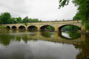
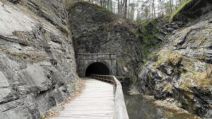
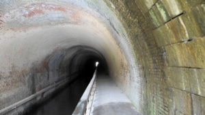
“Boats that departed the tide lock in Georgetown-towed at a steady two-and-a-half to four miles per hour-traveled through 74 lift locks, across 11 stone aqueducts and more than two hundred culverts, past seven supporting dams with inlets, and through the Paw Paw Tunnel (dug through 3,118’ of rock), rising 605’ to the terminus in Cumberland. Despite frequent flood damage, many army crossings during the Civil War and competition from the paralleling railroad, the C&O carried freight (mainly coal, lumber, and agricultural products) for nearly a century. Following brief financial success in the 1870’s, damage from a devastating 1889 flood sent the canal company into receivership with, ironically the B&O (the competitive parallel railroad the Baltimore & Ohio) in control. Another destructive flood in 1924 finally led to the canals closure to navigation.”
Like I said, Capt. Hahn says it very well. In 1938 the U.S. Government purchased the canal for $2 million dollars. The canal began to draw birdwatchers, fishermen, and those seeking a respite from city life. The National Park Service restored and re-watered the lower part of the canal, from Georgetown to just below the Great Falls of the Potomac.

There was a move afoot at this time to build a parkway type road on the remaining part of the canal so enter one of the most influential men in the history of the park: Associate Supreme Court Justice William O. Douglas. Justice Douglas challenged the editors of the Washington Post and Evening Star newspapers to hike from Cumberland to Georgetown with him to argue the preservation of the canal. In Justice Douglas’s words “ It is a refuge, a place of retreat, a long stretch of quiet and peace at the Capitals back door-a wilderness area where man can be alone with his thoughts, a sanctuary where he can commune with God and nature, a place not yet marred by the roar of wheels and the sound of horns”. The eight day “Douglas Hike” did the job and swayed public opinion and the parkway idea was abandoned. In 1961 President Dwight D. Eisenhower made the canal a National Monument. In 1971 it became The Chesapeake & Ohio Canal National Historic Park.
So now you’re probably wondering “Why did Trent have me read all of that History?”

I believe knowing where you come from is just as important as where you are now. Large parts of my family have been connected to the Potomac River in one way or another since the early 18th century. I grew up on the river and canal, fished it with my grandfather and my father, as well as spending many happy hours when I was young walking the towpath and traveling by boat on the river with my parents and younger brother.
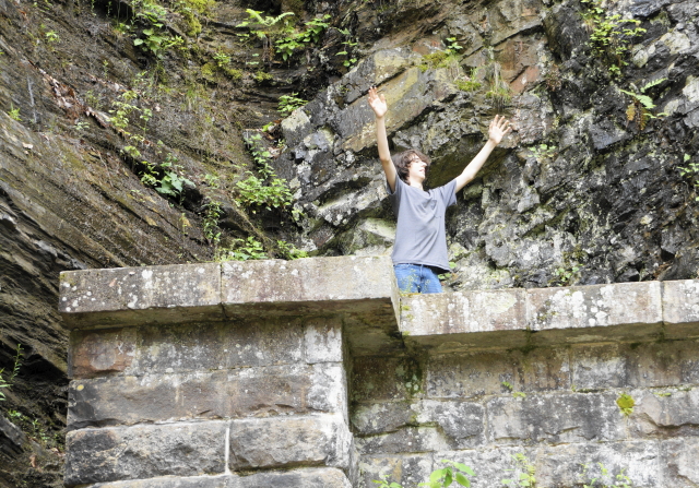
It was only natural that I would take Arthur there, and he took to it like a fish does to water. He loved history, nature, fishing, and adventure all of which you can find on the C&O Canal and Potomac River.
The canal is unique in many ways, it is the only reasonably well preserved 19th century canal surviving into the 21st century. It is a monument to the men and women that built it and worked on it, it is also a testament to that early American ethic of getting things done. But it is also something more.
You can start walking in Georgetown, dodging people staring at their phones and sipping expensive coffee, then end up in Western Maryland where you might have to avoid a black bear or an angry beaver. Anywhere on this path you may see a bald eagle or an osprey. As Justice Douglas said it is a wilderness area, very narrow in spots, but wilderness just the same. You can bike it, walk it, ride a horse on most of it, or paddle the river in a canoe or kayak. There are isolated places to camp every 5 or 6 miles plus drive in camps for less active types.
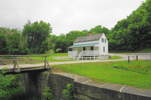
In some areas you can stay in a restored 19th century lock keepers house and in a few places you can take a ride in a replica of a canal boat. This is what Arthur loved about the canal. So all of that history was about where some of Arthur’s ancestors came from and the C&O Canal and Potomac River were places that he enjoyed and loved. Part of the 186 Mile Project is to preserve his memory as well as to actively work to protect this place that he and I enjoyed so much. Hopefully I will be able to share some of the wonder he and I found in this unique place with some of you reading these words.
Trent Carbaugh
Afterword
In a way George Washington’s dream has been fulfilled, kind of in a different way than he intended, though, for recreation not commerce. The Potomac Heritage Trail is a network of hiking trails, paddling routes and bike paths that connect Pittsburgh PA. (the start of the Ohio River) to the Chesapeake Bay. The C&O Canal and the Potomac River are the centerpiece as well as the longest contiguous section of this system.
This is but a short history lesson and should you want to learn more (and there is quite a bit more) I would suggest going to the C&O Canal Association website as a start. There is a wealth of information available here; the articles by Dr. Karen Grey are especially informative and very well written.
You could also just go to the C&O Canal and have a look for yourself.
Short Bibliography and Continued Reading:
Thomas F. Hahn, Towpath Guide to the C&O Canal, Revised Edition, 2015, Harpers Ferry Historical Association, Harpers Ferry WV, ISBN 978-0-9674033-1-1
- Various articles from the C&O Canal Association members, available on the association’s website, www.candocanal.org
- Dan Guzy, Navigation on the Upper Potomac River and its Tributaries, 2008, Chesapeake and Ohio Canal Association, Glen Echo MD.
- Earnest Dupuy and Trevor N. Dupuy, The Encyclopedia of Military History, From 3500 B.C. to the Present, 1986, Harper & Row, Publishers, NY, ISBN 0-06-181235-8
- Richard L. Stanton, Potomac Journey, Fairfax Stone to Tidewater, 1993, Smithsonian Institution, Washington DC. ISBN 1-56098-218-7
- National Park Service, Chesapeake and Ohio Canal, Handbook 147, U. S. Department of the Interior, Washington DC. Revised edition 2015
If you really want to learn more join the C&O Canal Association, you can do volunteer work in the Park, historical research, and be around some really great people that understand (much more than I do) the history and nature that abound in this place.
C&O Canal Association, Box 366, Glen Echo, MD 20812 inquiries@candocanal.org www.candocanal.org